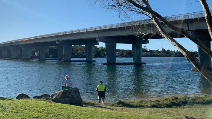
Should this bridge mark the point where Queensland ends and NSW begins?
Gold Coast Mayor Tom Tate argues the Queensland border should move south to make the Tweed River the natural boundary, and he might have a point, writes Peter McCutcheon.
Gold Coast Mayor Tom Tate doesn’t enjoy a reputation as one of Queensland’s most articulate political leaders.
So when Tate last week floated the idea of moving the state border further south, many assumed it was either a joke or a miscommunication.
But yesterday, amid talk of border restrictions amid the ongoing pandemic, the Mayor insisted he was not only dead serious but wanted the Queensland Premier to discuss the proposal with her New South Wales counterpart and even take it to National Cabinet.
“It really makes natural sense,” he said.
“Mother nature has got Tweed River there and all I’m saying is that have the border line and you feel like once you cross from Banora Point to Chindera, that’s when most people feel that they’ve entered NSW, so … make it come good.”
Tate is proposing to move the border 7km south, ostensibly to ease the border traffic problems created by COVID-19 checkpoints.
Either willingly or unwillingly, he’s also touched on a politically inconvenient truth — the border between the two states appears to be in the wrong place.
You might like
From the Captain Cook Memorial at Tweed Heads, the border winds its way through half a dozen urban streets then bisects the Gold Coast Airport.
“A third of the airport is actually in New South Wales,” historian and University of Queensland Emeritus Professor Peter Spearritt explained.
“When the border was closed for the COVID-19 lockdown, the NSW passengers could have disembarked on one side of the airport, and the Queensland passengers could have got out on the other side,” he joked.
From the airport, the border continues to meander well north of the Tweed River — a feature Tate and many others have suggested might be a more natural line of delineation.
This seemingly random line on the map has practical consequences — playing havoc in summer with two different time zones and, as the Mayor mentioned half in jest yesterday, making up to 30 per cent difference in property values.
Why is the border where it is?
Spearritt said the line on the map represented the political realities of colonial Queensland and New South Wales in the late 1850s.
An initial proposal to draw a line at 30 degrees south was strongly rejected by squatters in the Armidale and New England districts who feared they’d be cut off from their power base in Sydney, the capital of the richest colony on the continent.
Stay informed, daily
So eventually it was agreed the line would be drawn about 28 degrees south, roughly along the line of the Tweed River, although Spearritt suspects the natural waterway back then wasn’t as clearly defined as it is today.
“There would have been two very small, discrete communities each side of the Tweed River,” Spearritt said.
“On the New South Wales side, the Northern Rivers region was not looking north — it was focused on Sydney to the south.
“Mullumbimby had two freight trains a day to shift bananas down to Sydney, right through the 1970s.”
The New South Wales train system ended at Murwillumbah, then Queensland’s started at Coolangatta.
Neither state government was in a hurry to build a railway bridge over the Tweed River.
It was only with the development of the Gold Coast from the 1960s that the urban footprint expanded to take in both sides of the border.
These days, the Northern Rivers region effectively looks north — emergency cases from Lismore Hospital are flown to the Gold Coast, the city into which an increasing number of northern NSW residents head daily for work.
The border remains the same place as it has always been since 1859 when the region was a remote backwater.
And that line on the map is expected to stay there for years to come, despite the Gold Coast Mayor’s pleas.
– ABC / state political correspondent Peter McCutcheon
Want to see more stories from InDaily Qld in your Google search results?
- Click here to set InDaily Qld as a preferred source.
- Tick the box next to "InDaily Qld". That's it.